Limnology
Canales Educativos
Explorar
Encontrar canales parecidos
🇪🇸 Español
🇺🇸 English
🇷🇺 Русский
🇧🇷 Português
🇸🇦 العربية
🇰🇷 한국어
🇫🇷 Français
🇹🇷 Türkçe
🇩🇪 Deutsch
🇮🇩 Bahasa Indonesia
🇹🇭 ไทย
🇵🇱 Polski
🇮🇹 Italiano
🇨🇳 中文
🇯🇵 日本語
🇻🇳 Tiếng Việt
🇧🇩 বাংলা
🇱🇰 සිංහල
Canales Parecidos A GIS & RS Solution
GIS & RS Solution
17,300
2.63
%
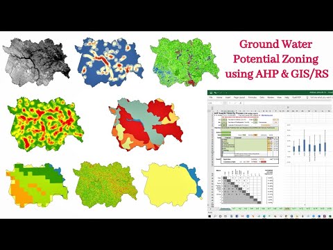
Identification of Groundwater Potential Zone using GIS/Re...
Study Area Mapping | Create Map Layout in ArcGIS
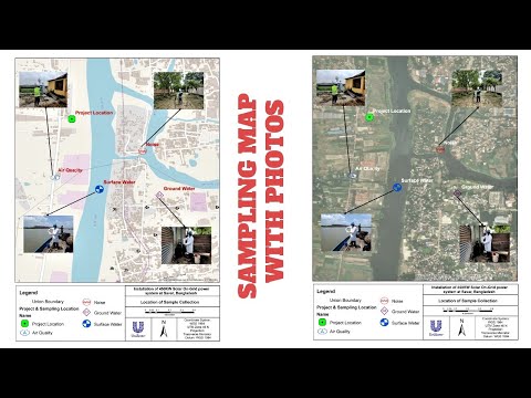
Sampling/Monitoring/Survey Map with Photos
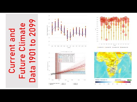
Download Present and Future Climate Data 1901 to 2099
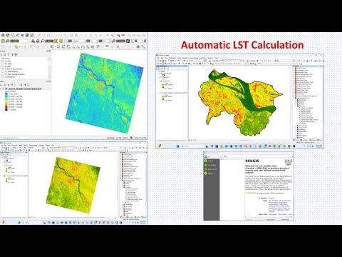
Automatic Land Surface Temperature (LST) Calculation and ...
Can't Find Layers or Browser Panel in QGIS? (Quick Fix!)
GeoDelta Labs
47,800
2.23
%
How DeepSeek AI Helped Me Create Maps Effortlessly
A Complete Beginner's Guide to ArcGIS Desktop (Part 1)
Calculating NDVI using Satellite Imagery with QGIS
Geospatial Python with GeoPandas - Introduction
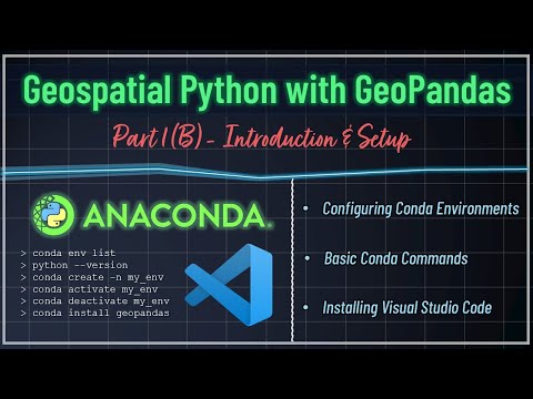
Basic Conda Commands and Installing Visual Studio Code (V...
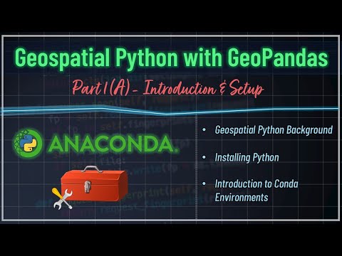
Background, Installing Python & Introduction to Conda Env...
MIT OpenCourseWare
3,390,000
1.13
%
1. Introduction to the Human Brain
How to Speak
How opening learning can close knowledge gaps with June O...
Alleviating poverty and sharing knowledge globally with E...
07. EdTech Before the Internet
09. Massive Open Online Courses (MOOCs)
Learn GIS & R
6,010
1.72
%
ArcGIS 10.8 download with CRACK and install on windows | ...
GIS Tutorial | Part 1 | How to make a shapefile or study ...
Top 5 data sources to download spatial data | Download sh...
GIS Tutorial | Part 08 | Create Spatial Distribution Map ...
Guantanamera | Sister Sister | Bohemeo's
GIS Tutorial | Part 7 | How to create elevation map for a...
GeoTech Studio
5,130
2.77
%
Removing Scan Line Error of Landsat 7 Using ArcGIS Lands...
A Complete Beginner's Guide for QGIS 3 || QGIS for Beginn...
Introduction to R || Interface|| R Series || Video 1|| @g...
ArcGIS Model Builder || How to create Simple Model in Arc...
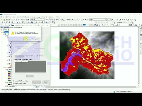
Land Use,Slope and Soil definitions||HRU analysis || Part...
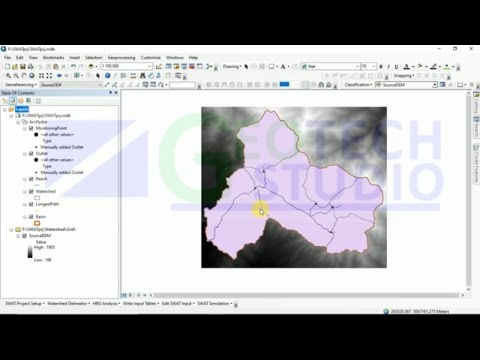
LULC Text File Preparation || Project Setup || Watershed ...
Moulay Anwar Sounny-Slitine
5,050
0.9
%
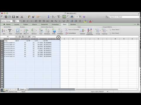
How to Convert Lat Long in DMS to Decimal Degrees in Excel
How to make a simple map in ArcMap
What Is Geography? The Surprising Science of Where, Why T...
hosting a webpage on GitHub Pages Hello World
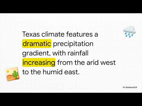
The Wild Weather of Texas
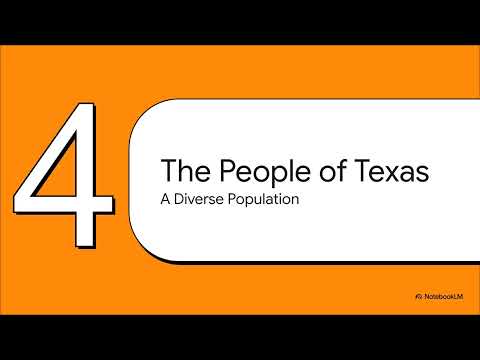
Texas Lone Star State
Map & GIS Library
5,090
0.45
%
Georeferencing in ArcMap Tutorial
Accuracy Assessment of an Image Classification in ArcMap
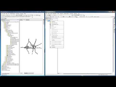
Re-Projecting Multiple Shapefiles
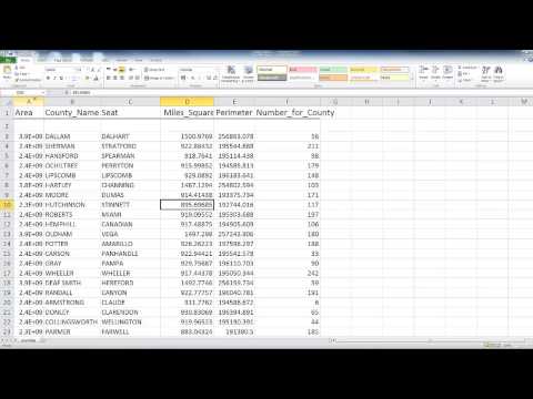
Formatting an Excel file for ArcMap
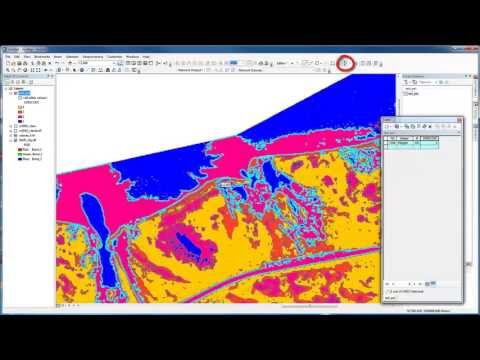
Unsupervised Image Classification in ArcMap
Changing projections of XY data from Decimal Degrees to a...
Related Keywords